LiDAR, which stands for Light Detection and Ranging, represents a pivotal remote sensing technology that has evolved from a specialized tool into a cornerstone of modern measurement and perception systems. A LiDAR rangefinder sensor operates on a fundamentally simple yet powerful principle: it emits pulses of laser light and precisely measures the time it takes for each pulse to reflect off a target and return to the sensor. This time-of-flight measurement, when combined with the known speed of light, allows for the calculation of exact distances with remarkable accuracy, often down to the centimeter level.
The core components of a LiDAR system include the laser emitter, the scanner and optics, the photodetector or receiver, and a sophisticated timing circuit. Modern systems typically use eye-safe, near-infrared lasers. The scanner, often a rotating mirror or a solid-state component, directs these laser pulses across a field of view. As the pulses strike objects in the environment, they scatter. A portion of this reflected light is captured by the receiver optics. The photodetector, commonly an avalanche photodiode, converts this faint optical signal into an electrical one. The system's processor then analyzes the return signal's timing and intensity to generate a precise distance value for each pulse.
This process is repeated millions of times per second, creating a dense "point cloud"—a massive collection of individual data points in three-dimensional space. Each point has precise X, Y, and Z coordinates, effectively building a detailed digital replica of the scanned environment. The intensity value of the return can also provide information about the surface material of the target.
The applications of LiDAR rangefinder sensors are vast and continually expanding. In the automotive industry, they are a critical sensor for autonomous vehicles and advanced driver-assistance systems (ADAS). Mounted on cars, they create a real-time, high-resolution 3D map of the vehicle's surroundings, enabling it to identify pedestrians, cyclists, other vehicles, and road boundaries with high reliability, even in low-light conditions. This capability for precise object detection and tracking is essential for navigation and collision avoidance.
Beyond automotive, topographic LiDAR mounted on aircraft or drones has revolutionized geography, forestry, and archaeology. It can penetrate vegetation canopies to map the underlying ground terrain, leading to the discovery of ancient structures hidden in dense jungles. It is indispensable for creating highly accurate digital elevation models used in urban planning, flood risk mapping, and infrastructure projects. In robotics and industrial automation, LiDAR sensors provide the spatial awareness necessary for robots to navigate dynamic factory floors, manage inventory in warehouses, and perform complex tasks safely alongside human workers.
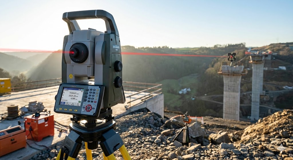
The construction and surveying sectors rely heavily on LiDAR for as-built documentation, progress monitoring, and volume calculations. It allows for rapid, accurate site surveys compared to traditional methods. Furthermore, environmental scientists use it to measure biomass, track glacier retreat, and monitor coastal erosion with unprecedented detail.
Recent advancements are pushing the boundaries of LiDAR technology. Solid-state LiDAR, which has no moving mechanical parts, promises greater durability, smaller form factors, and lower costs, accelerating adoption in consumer-grade applications. The development of frequency-modulated continuous-wave (FMCW) LiDAR adds the capability to measure the instantaneous velocity of a target directly by detecting the frequency shift in the reflected light, a significant advantage for tracking moving objects. Meanwhile, efforts to reduce size, power consumption, and cost are making high-performance LiDAR more accessible than ever before.
Despite its strengths, challenges remain. Performance can degrade in adverse weather conditions like heavy fog, rain, or snow, as particles scatter the laser beams. The high cost of some high-performance units has been a barrier to mass-market adoption, though this is changing rapidly. Processing the enormous data streams from LiDAR sensors also requires significant computational power. Nevertheless, ongoing research into sensor fusion—combining LiDAR data with camera and radar inputs—is creating more robust and resilient perception systems.
In conclusion, the LiDAR rangefinder sensor is far more than a simple distance-measuring device. It is an enabling technology that provides machines with a rich, three-dimensional understanding of their environment. As the technology continues to mature, becoming smaller, more robust, and more affordable, its integration into our daily lives and industrial processes will only deepen, driving innovation across transportation, environmental management, robotics, and beyond, and fundamentally reshaping how we measure, map, and interact with the world.