The evolution of smart transportation systems hinges on the acquisition of precise, real-time environmental data. Among the myriad of sensing technologies, infrared laser road surface sensors have emerged as a critical component for modern infrastructure, offering unparalleled accuracy in monitoring road conditions. These sensors operate on the principle of active remote sensing, typically utilizing a Class 1 or Class 2 infrared laser diode operating in the near-infrared spectrum (often around 850nm or 905nm). This wavelength is chosen for its minimal interference from ambient sunlight and its safety for human exposure. The core mechanism involves emitting a modulated laser beam towards the road surface and analyzing the reflected signal.
The primary data points extracted are distance and reflectivity. By employing time-of-flight (ToF) or phase-shift measurement techniques, the sensor calculates the exact distance to the road surface with millimeter-level precision. This allows for the detection of minute changes in road geometry, such as rutting, potholes, or surface wear. Concurrently, the intensity of the reflected laser pulse is measured. The reflectivity, or albedo, of the road surface is directly influenced by its condition. A dry asphalt surface has a characteristic reflectivity. The presence of water, ice, snow, or oil drastically alters this value. Water, for instance, can cause specular reflection, leading to a signal loss, while ice presents a different reflective signature compared to wet asphalt. Advanced sensors use multi-echo detection to distinguish between the reflection from the water film and the actual road surface beneath.
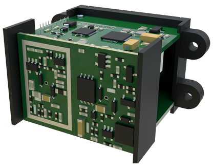
The engineering applications are vast and transformative. For winter maintenance, these sensors provide definitive, point-specific data on road surface state (dry, damp, wet, icy, frosty, snow-covered). This moves beyond reliance on atmospheric weather forecasts and ambiguous pavement temperature readings. Maintenance crews can optimize salt and de-icer application, deploying resources only where and when needed, leading to significant cost savings and reduced environmental impact. In the realm of traffic safety, integrated sensor networks can warn vehicles or traffic management centers about sudden changes in friction potential—a patch of black ice on a bridge, for example. This data is crucial for activating dynamic speed limit signs or alerting connected and autonomous vehicles (CAVs), allowing them to adjust speed and following distance autonomously.
Furthermore, these sensors contribute to predictive infrastructure maintenance. By continuously monitoring surface degradation and the formation of potholes, transportation agencies can shift from reactive to proactive repair schedules. Long-term trend analysis of rut depth or surface texture can inform lifecycle management and capital planning for road resurfacing projects. The integration of infrared laser sensors into a broader Internet of Things (IoT) framework is the logical next step. A single sensor node may combine laser ranging with a thermopile for surface temperature, an optical camera for visual validation, and communication modules (e.g., LoRaWAN, 5G). This multi-modal data fusion creates a robust and reliable picture of road conditions.
Deployment considerations are paramount for engineers. Sensor mounting height, angle, and location must be carefully calibrated to ensure the laser spot samples a representative area of the traffic lane and is not obstructed by spray from vehicles. Robust housing is required to withstand extreme temperatures, vibration, moisture ingress (IP67 rating or higher), and chemical exposure from road salts. Power supply can be a challenge in remote locations, often necessitating solar panels with battery storage. Data processing algorithms must also account for "false positives," such as debris or tire marks, often employing machine learning models trained on vast datasets to classify surface conditions accurately.
Looking ahead, the convergence of higher-resolution laser scanning (LiDAR-like profiling), advanced spectroscopy to identify chemical contaminants, and edge computing for real-time analytics will further enhance the capabilities of road surface sensors. The goal is a fully digitized "tactile" layer for road networks, where the infrastructure itself senses and communicates its condition. Infrared laser road surface sensors are not merely instruments; they are foundational enablers for safer, more efficient, and more sustainable transportation ecosystems. Their continued development and widespread deployment are essential steps toward building the resilient and intelligent infrastructure demanded by the future of mobility.