Snow depth measurement is a critical task across numerous industries and research fields. From avalanche forecasting to water resource management, accurate snow data influences safety decisions, environmental monitoring, and climate science. For decades, manual snow stakes and ultrasonic sensors have been common tools. However, the advent of laser snow depth sensors represents a significant technological leap, offering superior precision, reliability, and automation. This article explores the principles, applications, and advantages of these advanced instruments.
At its core, a laser snow depth sensor operates on the principle of time-of-flight measurement. The device emits a focused pulse of laser light towards the ground. This light travels through the air, reflects off the snow surface, and returns to a detector in the sensor. An internal high-speed clock precisely measures the time elapsed between the emission and the detection of the reflected pulse. Since the speed of light is a known constant, the sensor's onboard processor can calculate the exact distance to the snow surface. By installing the sensor at a known height above a fixed ground reference point (like soil or a permanent platform), the system can continuously derive snow depth by subtracting the measured distance from the total installation height.
This method offers distinct advantages over older technologies. Ultrasonic sensors, which use sound waves, can be affected by temperature gradients, wind, and the speed of sound's variability with air conditions. Laser sensors, using light, are virtually immune to these atmospheric interferences, providing more stable and accurate readings. Their focused laser beam also minimizes issues with target size and peripheral obstructions that can plague ultrasonic devices.
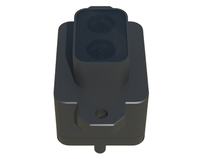
The applications for laser snow depth sensors are vast and growing. In avalanche safety, they are deployed in remote mountain stations, providing real-time data on snowpack accumulation. This information is vital for forecasting models and issuing public warnings. For ski resorts, these sensors help monitor snow conditions on slopes, aiding in snowmaking operations and grooming schedules to ensure optimal and safe skiing surfaces.
In hydrology and water resource management, snow is often referred to as "frozen reservoir." Accurate, basin-wide snow depth and snow water equivalent (SWE) data are crucial for predicting spring runoff, managing reservoir levels, and planning irrigation for agriculture. Networks of laser sensors, often part of larger automated weather stations, provide this essential data with minimal human intervention, even in harsh, inaccessible environments.
Climate research is another major beneficiary. Long-term, high-fidelity snow depth records are key indicators of climate change. Laser sensors contribute to this dataset by providing consistent, automated measurements that help scientists track trends in seasonal snow cover duration and volume over years and decades.
Key considerations when deploying these sensors include installation and environmental factors. For optimal performance, the sensor must be mounted securely and level, high enough to remain above maximum expected snow depth. The laser requires a clear line of sight to the ground reference. While modern sensors are built for durability, heavy rime ice or wet snow accumulation on the sensor window can temporarily block the laser. Many models now include heating elements to mitigate this issue. Data logging and transmission are also critical; most systems integrate cellular, satellite, or radio telemetry to send data to central servers for analysis and dissemination.
The evolution of laser snow depth sensing technology continues. Modern units are becoming more compact, energy-efficient, and cost-effective. Integration with other meteorological sensors (for temperature, wind, humidity) and IoT platforms is creating comprehensive environmental monitoring stations. The data from these sensors is increasingly used to validate and improve satellite-based remote sensing of snow cover, creating a powerful multi-scale observation system.
In conclusion, laser snow depth sensors have transformed how we measure and understand snow. By providing accurate, reliable, and automated data, they support critical decisions in public safety, resource management, and scientific research. As technology advances and costs decrease, their deployment is likely to expand, further illuminating the vital role snow plays in our global environment and water cycles.