LiDAR, which stands for Light Detection and Ranging, is a remote sensing technology that uses laser pulses to measure distances and create detailed three-dimensional representations of objects and environments. In recent years, this technology has been adapted and refined for specialized applications in plant science and agriculture, giving rise to what are commonly termed plant LiDAR sensors. Understanding the core principles behind these sensors is key to appreciating their transformative role in precision agriculture, forestry, and ecological research.
At its most fundamental, a LiDAR system operates on the principle of time-of-flight measurement. The sensor emits a rapid pulse of laser light towards a target, such as a leaf, branch, or the ground beneath a canopy. This light travels at a constant speed (the speed of light). When the pulse hits a surface, a portion of the light is reflected back towards the sensor. A highly sensitive detector within the sensor records the return signal. By precisely measuring the time interval between the emission of the pulse and the detection of its return, the sensor can calculate the distance to the target with remarkable accuracy. The formula is straightforward: Distance = (Speed of Light × Time of Flight) / 2.
Plant LiDAR sensors, however, are not merely distance meters. They are engineered to capture the complex structural architecture of vegetation. This is achieved through two primary scanning methods: discrete-return and full-waveform LiDAR.
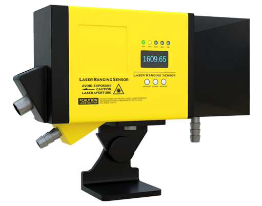
Discrete-return LiDAR systems record individual, distinct returns from each laser pulse. A single pulse might generate multiple returns as it penetrates a plant canopy; it might first hit the top leaf, then a lower branch, and finally the ground. Advanced systems can record the first, last, and several intermediate returns. This data allows scientists to construct a detailed point cloud—a massive collection of millions of XYZ coordinates in space. From this cloud, crucial metrics can be derived, such as canopy height, canopy cover density, leaf area index (LAI), and the vertical distribution of plant material. These metrics are invaluable for assessing crop health, predicting biomass, and monitoring growth stages.
Full-waveform LiDAR provides an even richer data source. Instead of recording just a few discrete points, it digitizes the entire shape of the reflected laser pulse as it returns. As the laser pulse interacts with a complex structure like a tree, the return signal is a composite waveform. Deconstructing this waveform offers insights into the density and arrangement of foliage and woody material at different heights within the canopy. It allows for a more nuanced understanding of canopy porosity and internal structure, which is particularly useful for detailed ecological modeling and carbon stock estimation.

The hardware configuration of plant LiDAR systems varies based on the platform. Terrestrial Laser Scanners (TLS) are ground-based, stationary units that provide extremely high-resolution, 360-degree scans of individual plants or small plots. Mobile Laser Scanners (MLS) are mounted on vehicles or carts, enabling the rapid scanning of larger areas like orchards or field trials. The most expansive data collection comes from Airborne Laser Scanning (ALS), where sensors are mounted on drones or aircraft, facilitating the mapping of vast forests or entire farms.
Several key factors influence the performance and data quality of plant LiDAR. The laser wavelength is critical. Most systems use near-infrared (NIR) lasers, as vegetation reflects strongly in this spectrum, providing a good signal. The pulse repetition rate (how many pulses per second are emitted) and scanning speed determine the density of the point cloud. Higher density yields more detailed models but generates larger datasets. The beam divergence, or the spread of the laser beam, affects the size of the footprint on the target, influencing the ability to resolve fine details like small twigs or narrow gaps in foliage.
The raw distance measurements from a LiDAR sensor are just the beginning. Sophisticated data processing pipelines are required to transform point clouds into actionable information. This involves filtering noise, classifying points into categories (e.g., ground, vegetation, non-vegetation), and applying algorithms to extract the desired biophysical parameters. The integration of LiDAR data with other data sources, such as multispectral or hyperspectral imagery, is a powerful trend. This fusion, sometimes called "hyperspectral LiDAR" in research, combines detailed structural data with chemical and physiological information (like chlorophyll content), creating a comprehensive picture of plant health and function.
In application, the principles of plant LiDAR enable groundbreaking work. In agriculture, sensors on tractors or drones can map crop height variability, guiding variable-rate irrigation or fertilization. In forestry, LiDAR is used for inventory management, measuring tree height and volume with unprecedented efficiency. Ecologists use it to map habitats, monitor deforestation, and study biodiversity by quantifying the three-dimensional complexity of ecosystems.
In conclusion, the principle of plant LiDAR sensors rests on the precise measurement of laser light travel time to map the three-dimensional structure of vegetation. By evolving from simple ranging to sophisticated multi-return and full-waveform analysis, these sensors decode the architectural language of plants. As the technology continues to advance in portability, speed, and data fusion capabilities, its role in sustainably managing and understanding the plant world will only deepen, offering a non-invasive, quantitative eye on the living landscape.