Lidar, an acronym for Light Detection and Ranging, is a remote sensing method that uses light in the form of a pulsed laser to measure variable distances to the Earth. This technology generates precise, three-dimensional information about the shape of the Earth and its surface characteristics. The fundamental principle of lidar is conceptually similar to radar (Radio Detection and Ranging), but instead of radio waves, it employs light waves from a laser.
A typical lidar sensor system consists of several key components: a laser source, a scanner and optics, a photodetector and receiver electronics, and a precise timing circuit. The core operation involves emitting rapid pulses of laser light towards a target. The scanner, often a rotating mirror or a solid-state mechanism, directs these pulses across a specific field of view. When a laser pulse hits an object, it is reflected back towards the sensor. The photodetector, a highly sensitive device, captures this returning light signal.
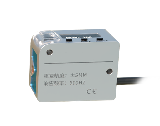
The most critical measurement is the time interval between the emission of the pulse and the detection of the reflected signal. Since the speed of light (c) is a known constant (approximately 299,792,458 meters per second), the sensor's internal computer can calculate the distance (range) to the object using a simple formula: Distance = (Speed of Light × Time of Flight) / 2. The division by two accounts for the round-trip journey of the light pulse. By repeating this process millions of times per second and combining the distance data with the precise angular orientation of the scanner for each pulse, the system builds a dense, accurate point cloud—a massive collection of individual 3D coordinate points that map the surrounding environment.
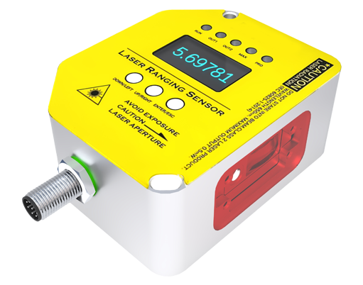
The type of laser used is crucial. Most terrestrial and automotive lidars operate in the near-infrared spectrum, typically around 905 nanometers or 1550 nanometers. The 1550nm wavelength is considered safer for human eyes at higher power levels and experiences less atmospheric attenuation, making it suitable for longer-range applications. The laser can operate in different modes. Pulsed Time-of-Flight (ToF) lidar, as described, is the most common for long-range, high-resolution mapping. Continuous-wave lidar, which measures the phase shift of a modulated laser beam, is often used for shorter-range, high-precision applications.
Advanced lidar systems incorporate multiple lasers and detection channels to increase the density of data points and the field of view. The scanning mechanism defines two primary architectures. Mechanical spinning lidars use a rotating assembly of laser emitters and receivers, providing a 360-degree horizontal field of view. Solid-state lidars, which are gaining prominence, have no moving macroscopic parts. They use techniques like Micro-Electro-Mechanical Systems (MEMS) mirrors, optical phased arrays, or flash illumination (where a single broad beam illuminates the entire scene at once) to steer the light. Solid-state designs promise greater durability, smaller form factors, and lower cost for mass production.
The data processing pipeline is equally important. Raw time-of-flight measurements are converted into distance values. These are then fused with inertial measurement unit (IMU) and Global Navigation Satellite System (GNSS) data, especially in airborne mapping, to georeference each point accurately. Sophisticated software algorithms filter noise, classify points (e.g., ground, vegetation, building), and can construct detailed 3D models or digital elevation maps.
Lidar's applications are vast and growing. In autonomous vehicles, it is a key sensor for creating real-time, high-definition 3D maps of the vehicle's vicinity, crucial for object detection, classification, and path planning. In topography and geography, airborne lidar is indispensable for creating digital terrain models, monitoring coastlines, and mapping forests. Archaeology uses it to discover hidden structures beneath forest canopies. In robotics and industrial automation, lidar guides autonomous mobile robots in warehouses and enables precise measurement and inspection. Environmental scientists employ it to measure atmospheric composition, cloud profiles, and wind speeds.
The performance of a lidar sensor is characterized by parameters such as range (maximum detection distance), accuracy (deviation from true distance), precision (repeatability of measurements), angular resolution (the smallest angular change it can detect), and frame rate (how often a complete scan is produced). Each application demands a specific balance of these parameters. For example, a self-driving car requires long range (over 200m) and high frame rate for highway speeds, while an indoor robot may prioritize high angular resolution over very long range.
Challenges and future directions for lidar technology include reducing cost for mass-market adoption, especially in consumer vehicles, improving performance in adverse weather conditions like heavy fog or rain, and further miniaturizing solid-state systems. Sensor fusion, where lidar data is seamlessly combined with camera and radar data, is a critical area of development to create robust perception systems for autonomy. Research into new semiconductor materials and photonic integrated circuits aims to make lidar sensors more compact, efficient, and affordable.
In summary, lidar operates on the straightforward principle of measuring the time for light to travel to an object and back. However, the engineering implementation involving advanced lasers, high-speed scanning, sensitive detection, and complex data processing transforms this simple principle into a powerful tool for perceiving and modeling the world in three dimensions. Its evolution from large, expensive airborne systems to potential integration into everyday devices continues to unlock new possibilities across numerous fields, from transportation and mapping to environmental science and beyond.