Laser rangefinder scanning represents a pivotal advancement in non-contact measurement technology, enabling engineers and technicians to achieve unprecedented levels of accuracy, speed, and safety across diverse industrial applications. At its core, this technology operates by emitting a focused laser beam toward a target surface. The sensor precisely measures the time it takes for the light to reflect back—a method known as time-of-flight (ToF)—or analyzes phase shifts in modulated laser light. This data is then converted into highly accurate distance measurements, often with sub-millimeter precision.
In industrial automation, laser scanning systems are integral for robotic guidance, quality control, and assembly verification. For instance, in automotive manufacturing, scanners map vehicle body dimensions in real-time, ensuring components like panels and windshields fit perfectly. Similarly, in aerospace, they verify the contour of aircraft wings and fuselage sections, where even minor deviations can impact aerodynamic performance. The ability to perform these measurements without physical contact eliminates risks of surface damage or deformation, a critical advantage when handling delicate or high-value components.
Beyond manufacturing, laser rangefinder scanning is transforming sectors like construction and civil engineering. Surveyors use terrestrial laser scanners (TLS) to create detailed 3D point clouds of structures, terrains, and historical sites. These digital twins facilitate precise volume calculations, deformation monitoring, and as-built documentation, significantly reducing manual labor and human error. In logistics, warehouse automation relies on scanning to track inventory, guide autonomous vehicles, and optimize storage layouts by accurately gauging spatial dimensions.
The technology's versatility is further enhanced by different scanning modalities. Static scanners capture comprehensive environmental data from fixed positions, while mobile or handheld units offer flexibility for on-site inspections. Some advanced systems incorporate simultaneous localization and mapping (SLAM) algorithms, allowing them to operate in dynamic, GPS-denied environments like underground mines or indoor facilities.
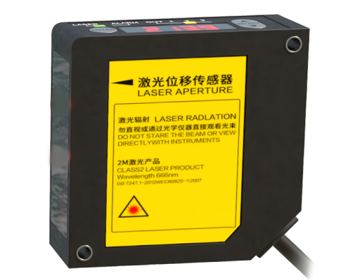
Key technical considerations when deploying laser rangefinder scanning include environmental factors. Ambient light, dust, fog, or highly reflective surfaces can interfere with laser signals, though many modern sensors integrate filtering algorithms and adaptive optics to mitigate these issues. Range and resolution must also be matched to the application—long-range scanners for topographical surveys may have lower resolution than short-range units for microscopic part inspection.
Looking ahead, integration with artificial intelligence and the Internet of Things (IoT) is set to amplify the impact of laser scanning. AI-driven analytics can automatically detect anomalies in scan data, predict maintenance needs, or optimize processes in real-time. Meanwhile, miniaturization and cost reduction are making the technology accessible to smaller enterprises and emerging fields like augmented reality (AR) for interactive design and training.
In conclusion, laser rangefinder scanning is not merely a tool but a foundational technology driving the fourth industrial revolution. By delivering exact, real-time spatial data, it empowers industries to enhance efficiency, ensure quality, and innovate with confidence. As sensor capabilities evolve and connectivity expands, its role in shaping smart factories, resilient infrastructure, and sustainable engineering solutions will only grow more profound.