LiDAR, which stands for Light Detection and Ranging, is a remote sensing method that uses pulsed laser light to measure variable distances to the Earth. This technology generates precise, three-dimensional information about the shape of the Earth and its surface characteristics. A LiDAR sensor, fundamentally, is a laser radar. It emits rapid pulses of laser light at a surface, some at up to 150,000 pulses per second. A sensor on the instrument measures the amount of time it takes for each pulse to bounce back. Because the speed of light is a known constant, these return times can be translated into highly accurate distance measurements. By scanning the laser across a landscape or object and aggregating millions of these data points, a detailed "point cloud" 3D model is constructed.
The core components of a LiDAR system include the laser source, scanner and optics, photodetector and receiver electronics, and positioning and navigation systems. Lasers used in LiDAR are typically in the near-infrared spectrum for terrestrial mapping, though other wavelengths are used for different applications. The scanner's role is crucial; it directs the laser pulses to create the desired pattern of points. Modern systems often use rotating mirrors or solid-state solutions with no moving parts for increased reliability. The receiver captures the reflected light, and sophisticated timing circuitry calculates the time-of-flight with nanosecond precision. For mobile or airborne systems, an integrated GPS and Inertial Measurement Unit (IMU) precisely records the sensor's position and orientation for each pulse.
LiDAR technology is broadly categorized based on its platform. Airborne LiDAR, mounted on aircraft or drones, is revolutionary for topographic mapping, forestry, and urban planning. Terrestrial LiDAR systems are tripod-mounted or mobile, used for surveying, civil engineering, and as a critical component in autonomous vehicles. The latter application deserves special attention. For self-driving cars, LiDAR sensors create a real-time, 360-degree high-resolution map of the vehicle's surroundings. This map is fused with data from cameras and radar to identify pedestrians, other vehicles, and road boundaries with exceptional accuracy, especially in low-light conditions where cameras may struggle. This environmental perception is foundational for path planning and collision avoidance.
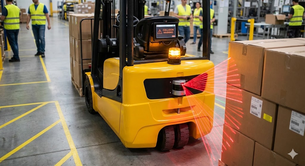
Beyond automotive, the applications are vast. In agriculture, LiDAR is used for crop health monitoring, yield prediction, and guiding autonomous tractors. In archaeology, it can "see through" dense forest canopies to reveal ancient structures. For infrastructure, it enables the digital twinning of bridges, power lines, and factories for monitoring and maintenance. Industrial automation relies on LiDAR for obstacle detection, volume measurement, and robotic guidance in warehouses and on production lines. Furthermore, environmental scientists use it to model flood risks, track glacier retreat, and quantify biomass in forests with unprecedented detail.
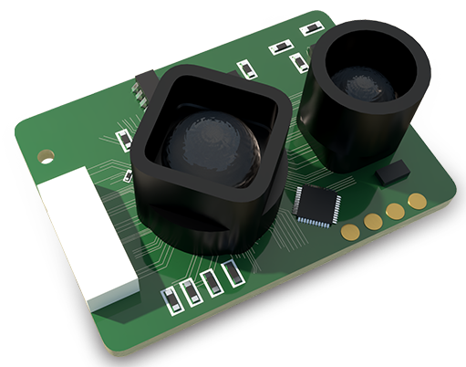
The evolution of LiDAR is marked by several key trends. The drive towards solid-state LiDAR (SSL) is perhaps the most significant. Unlike mechanical systems with spinning components, SSL uses phased arrays or micro-electro-mechanical systems (MEMS) to steer the laser beam electronically. This results in smaller, more robust, and potentially lower-cost sensors, which is critical for mass-market adoption in consumer vehicles. Another trend is the push for increased resolution and longer range while reducing power consumption and cost. Innovations in laser diodes and detector sensitivity are central to this. Additionally, sensor fusion—the intelligent combination of LiDAR data with radar, camera, and ultrasonic sensor inputs—is enhancing system redundancy and reliability, creating a more robust perception suite for safety-critical applications.
Looking ahead, the future of LiDAR is intertwined with advancements in computing and artificial intelligence. The sheer volume of point cloud data requires powerful edge processing. Machine learning algorithms are becoming adept at not just detecting objects but classifying them—distinguishing a bicycle from a motorcycle, or a pedestrian from a street sign—in real-time. Furthermore, the development of Frequency-Modulated Continuous Wave (FMCW) LiDAR promises to deliver not just distance but instantaneous velocity data for each point, adding a fourth dimension to perception. As costs continue to fall and performance rises, LiDAR's integration into more aspects of industrial automation, smart city infrastructure, and consumer electronics seems inevitable. It is transitioning from a specialized surveying tool to a ubiquitous component of the intelligent sensing landscape, enabling machines to perceive and interact with the world in three dimensions.