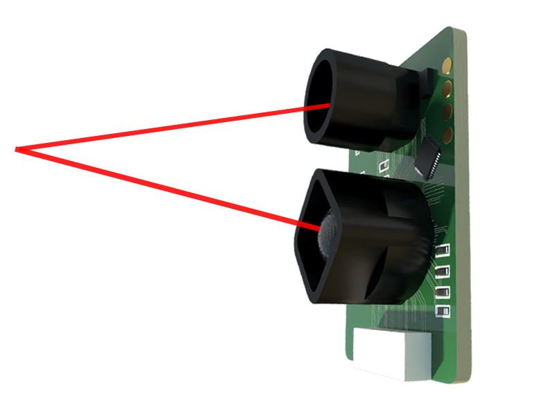
LiDAR, which stands for Light Detection and Ranging, is a remote sensing method that uses pulsed laser light to measure variable distances to the Earth. This technology, often referred to as Sensor LiDAR, has evolved from a specialized surveying tool into a critical component powering a wide array of modern applications. At its core, a LiDAR sensor emits rapid pulses of laser light towards a target. A highly sensitive receiver then measures the time it takes for each pulse to bounce back. By calculating the time-of-flight of these light pulses and knowing the exact speed of light, the system can generate precise, three-dimensional information about the shape and surface characteristics of the target.
The fundamental components of a Sensor LiDAR system include the laser source, scanner and optics, photodetector and receiver electronics, and positioning and navigation systems. Lasers used typically operate in the near-infrared spectrum for terrestrial mapping, while green light penetrates water for bathymetric studies. The scanner's role is crucial, as it directs the laser pulses across the desired field of view. Modern systems utilize various scanning mechanisms, such as rotating mirrors, micro-electro-mechanical systems (MEMS), or solid-state configurations with no moving parts, which offer greater durability and lower costs.
The data collected, known as a point cloud, consists of millions of individual points, each with precise X, Y, and Z coordinates. This dense 3D representation allows for the creation of highly accurate digital models of objects and environments. The resolution and accuracy of these models depend on factors like laser pulse frequency, scanning speed, and platform stability.
Sensor LiDAR's applications are vast and transformative. In the automotive industry, it is a cornerstone of autonomous vehicle development. Mounted on cars, LiDAR sensors continuously scan the surroundings, detecting other vehicles, pedestrians, cyclists, and road boundaries with high precision in real-time. This data is essential for navigation and collision avoidance systems, providing a level of environmental understanding that cameras and radar alone cannot achieve.
Beyond self-driving cars, LiDAR is revolutionizing topography and geography. It enables the rapid creation of high-resolution digital elevation models (DEMs) and digital terrain models (DTMs), which are invaluable for flood modeling, forestry management, and urban planning. Archaeologists use it to map hidden structures beneath forest canopies, while environmental scientists employ it to monitor coastal erosion and glacier retreat with unprecedented detail.
In the realm of robotics and industrial automation, Sensor LiDAR provides the eyes for machines. Warehouses use LiDAR-guided autonomous mobile robots for inventory management and logistics. Drones equipped with LiDAR conduct infrastructure inspections, surveying power lines, wind turbines, and bridges, identifying potential issues without requiring risky human intervention. The construction industry leverages LiDAR for site surveying, progress monitoring, and as-built verification, ensuring projects adhere precisely to digital blueprints.
Looking ahead, the future of Sensor LiDAR technology is geared towards miniaturization, cost reduction, and enhanced performance. Solid-state LiDAR, which eliminates bulky mechanical parts, is key to this evolution, promising more compact and affordable sensors suitable for mass-market consumer applications. Advances in semiconductor lasers and detectors continue to improve range, resolution, and power efficiency.
Furthermore, the integration of LiDAR data with other sensor modalities like cameras, radar, and inertial measurement units (IMUs) through sophisticated sensor fusion algorithms will create more robust and reliable perception systems. This is critical for safety-critical applications in autonomous mobility. Another emerging trend is the development of frequency-modulated continuous-wave (FMCW) LiDAR. This technology not only measures distance but can also detect the velocity of a moving object directly by analyzing the frequency shift of the reflected light, similar to radar principles. This adds a crucial fourth dimension of data.
In conclusion, Sensor LiDAR has moved far beyond its origins in atmospheric research. It is now an indispensable tool that is reshaping industries by providing machines with a precise, three-dimensional understanding of the world. As the technology becomes more accessible and capable, its role in enabling automation, enhancing scientific discovery, and improving safety will only continue to expand, solidifying its position as a foundational sensor of the intelligent digital age.