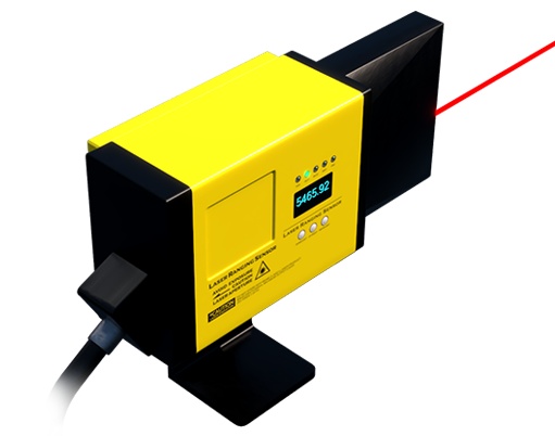
Lidar, an acronym for Light Detection and Ranging, represents a pivotal remote sensing technology that measures distance by illuminating a target with laser light and analyzing the reflected light. A lidar distance sensor, the core component of this system, functions as the eyes for a vast array of modern applications, from autonomous vehicles to industrial automation. Unlike traditional radar that uses radio waves or cameras that rely on ambient light, lidar sensors generate their own precise light pulses, enabling highly accurate, three-dimensional mapping of environments regardless of lighting conditions.
The fundamental operating principle of a lidar sensor is based on the time-of-flight (ToF) method. The sensor emits a short, focused pulse of laser light towards an object. This light travels at a constant speed—the speed of light. Upon striking the object, a fraction of the light is reflected back towards the sensor. A highly sensitive photodetector within the sensor captures this return signal. By precisely measuring the time interval between the emission of the pulse and the detection of its reflection, the sensor calculates the distance to the object with remarkable accuracy. The formula is straightforward: Distance = (Speed of Light × Time of Flight) / 2. Modern sensors perform this calculation millions of times per second, creating a dense point cloud—a massive collection of data points in space that accurately represents the surrounding environment.
Several key technologies define the performance and suitability of different lidar sensors. The primary distinction lies in the scanning mechanism. Mechanical rotating lidar systems, often seen on early autonomous vehicle prototypes, use spinning assemblies of lasers and receivers to provide a 360-degree field of view. Solid-state lidar, a more recent advancement, has no moving parts. It uses optical phased arrays or micro-electromechanical systems (MEMS) mirrors to steer the laser beam electronically, leading to greater durability, smaller size, and lower cost—factors critical for mass-market adoption. Another critical parameter is wavelength. Most terrestrial lidar systems operate at 905 nanometers or 1550 nanometers. The 1550nm wavelength is considered safer for human eyes at higher power levels, allowing for longer detection ranges, which is crucial for automotive applications on highways.
The applications for lidar distance sensors are expansive and transformative. In the automotive sector, they are a cornerstone of advanced driver-assistance systems (ADAS) and autonomous driving. By creating a real-time, high-resolution 3D map of the vehicle's surroundings, lidar helps cars detect pedestrians, cyclists, other vehicles, and road boundaries with exceptional reliability, especially in poor weather where cameras may struggle. Beyond automotive, lidar is revolutionizing robotics and drones, enabling autonomous navigation, obstacle avoidance, and precise mapping in warehouses, construction sites, and agricultural fields. In industrial settings, lidar sensors are deployed for precision measurement, volume profiling in logistics, and ensuring safety by creating intrusion detection zones around hazardous machinery. Furthermore, topographic mapping, forestry management, and archaeology benefit from airborne lidar's ability to penetrate vegetation and reveal ground contours.

Looking ahead, the future of lidar sensor technology is geared towards higher performance, miniaturization, and cost reduction. The industry is steadily progressing towards fully solid-state, chip-scale lidar solutions that can be integrated seamlessly into vehicles, smartphones, and consumer devices. Innovations like Frequency-Modulated Continuous Wave (FMCW) lidar are emerging. Unlike traditional pulsed ToF lidar, FMCW lidar uses a continuous laser beam whose frequency is modulated. This allows it to measure not only distance but also the instantaneous velocity of a target directly via the Doppler effect, providing a richer data set for perception systems. Another significant trend is sensor fusion—the sophisticated combination of lidar data with inputs from cameras, radar, and ultrasonic sensors. This fusion leverages the strengths of each technology (lidar's precise depth, camera's rich texture, radar's velocity and weather resilience) to create a more robust and redundant perception system, which is essential for safety-critical applications.
In conclusion, lidar distance sensors have evolved from specialized scientific instruments into enabling technologies for autonomy and smart systems. Their unique ability to provide accurate, real-time 3D environmental data under diverse conditions makes them indispensable. As research continues to drive down costs and improve integration, the proliferation of lidar will further accelerate, embedding this powerful sensing capability into the fabric of our automated world, from the roads we travel on to the factories that build our goods and the devices we use daily.